
SEE. UNDERSTAND. ACT.
Intelligent systems for remote operations.
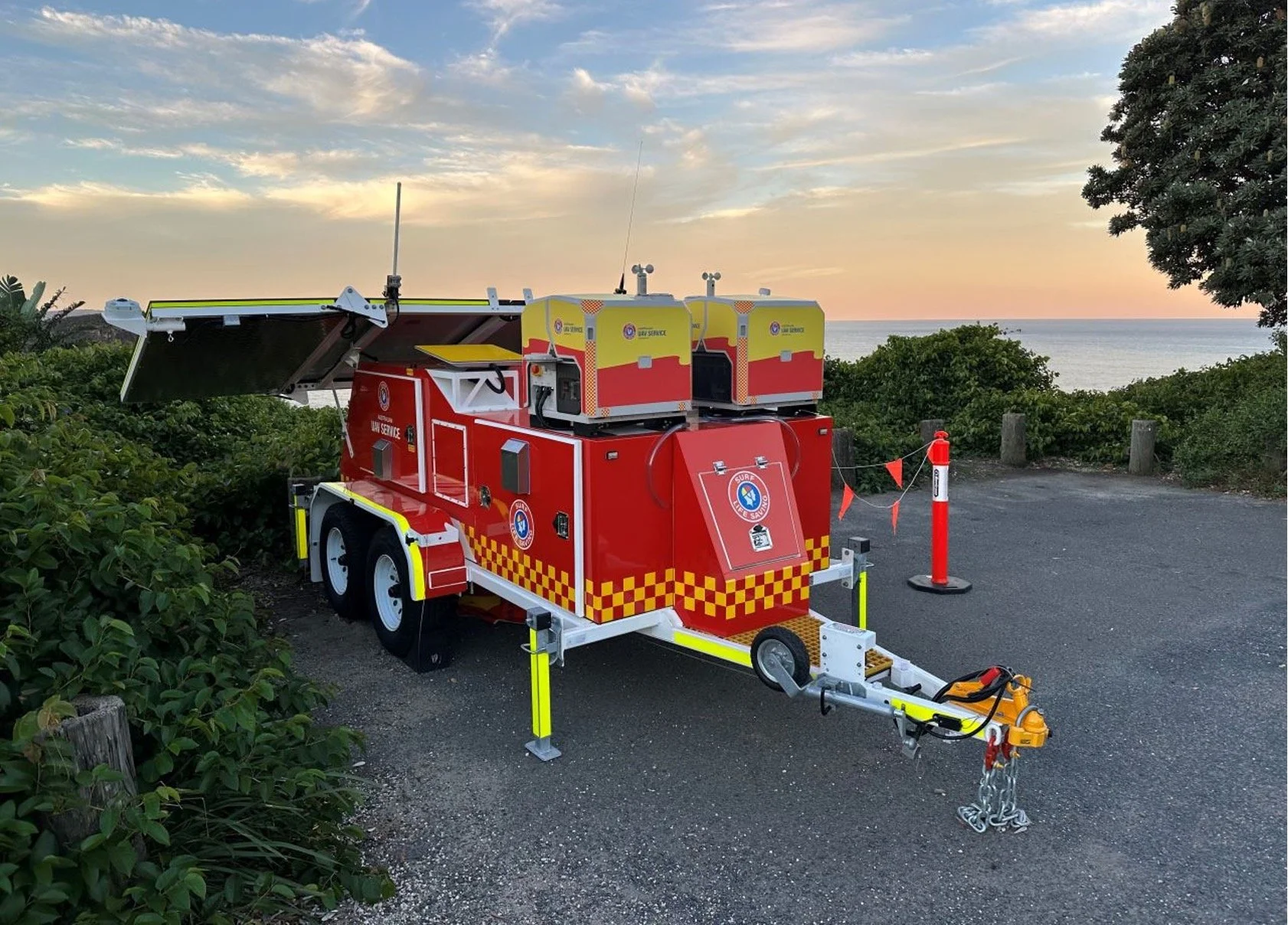
KushAI integrates drones, cameras and sensors with power, connectivity, AI and operational software to create systems that work in the field.
From mobile autonomous platforms to AI-assisted monitoring and decision support, we connect the full path from what happens remotely to what your team needs to know and do.
Complete field systems, integration into existing environments, and focused AI or software capability.
ONE SYSTEM. THREE LAYERS.
Field systems, intelligence and operator software — designed to work together.
Our focus is not a catalogue of disconnected services. It is the integration of the physical and digital layers required to run remote operations reliably.
-
Layer 1 · Field Systems
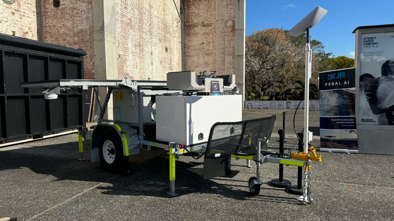
Mobile and fixed platforms combining drones, cameras, sensors, power, connectivity, edge compute and remote operations.
-
Layer 2 · Intelligence
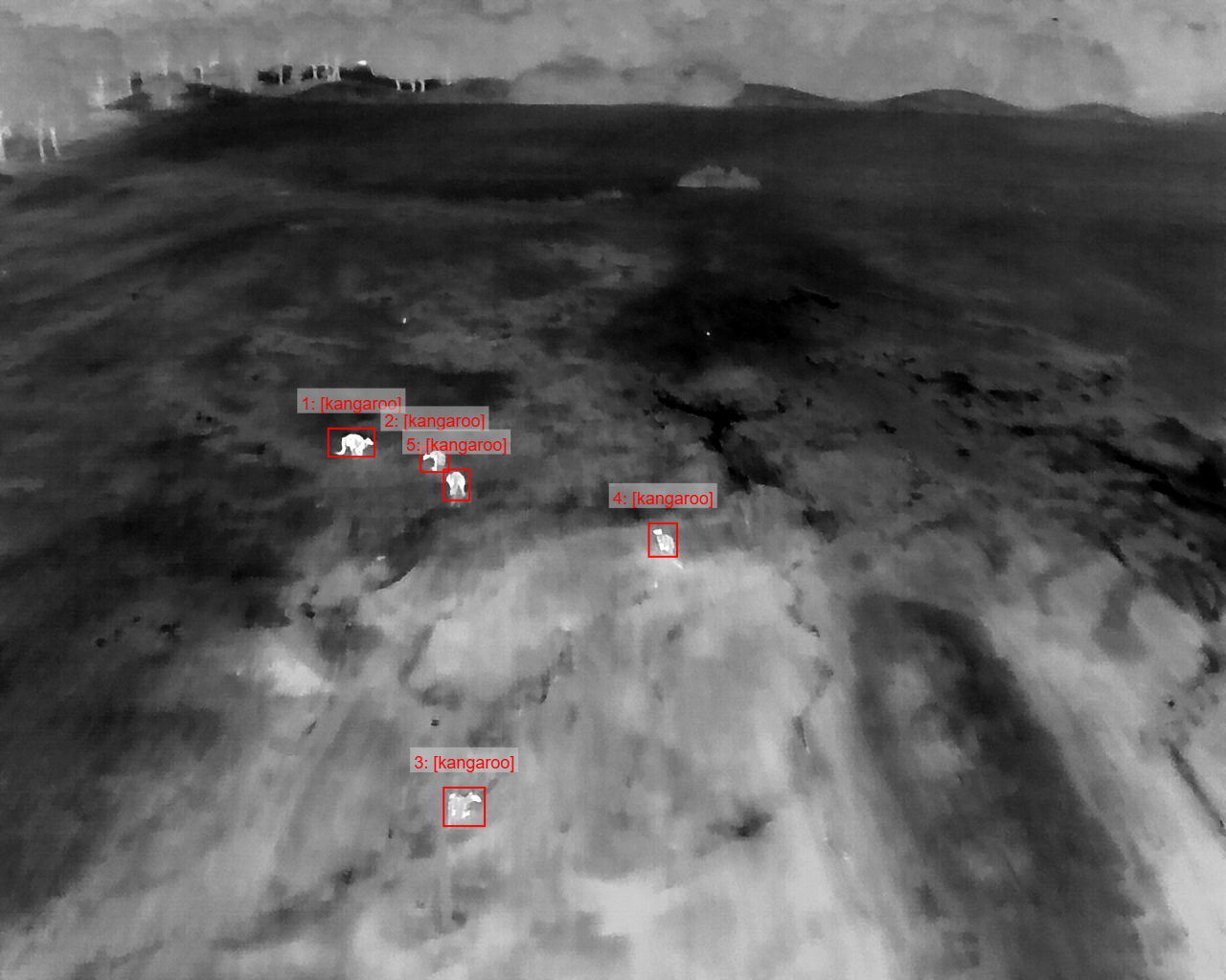
Computer vision, geospatial analytics and data processing that turn remote imagery and sensor data into useful information.
-
Layer 3 · Operator Software
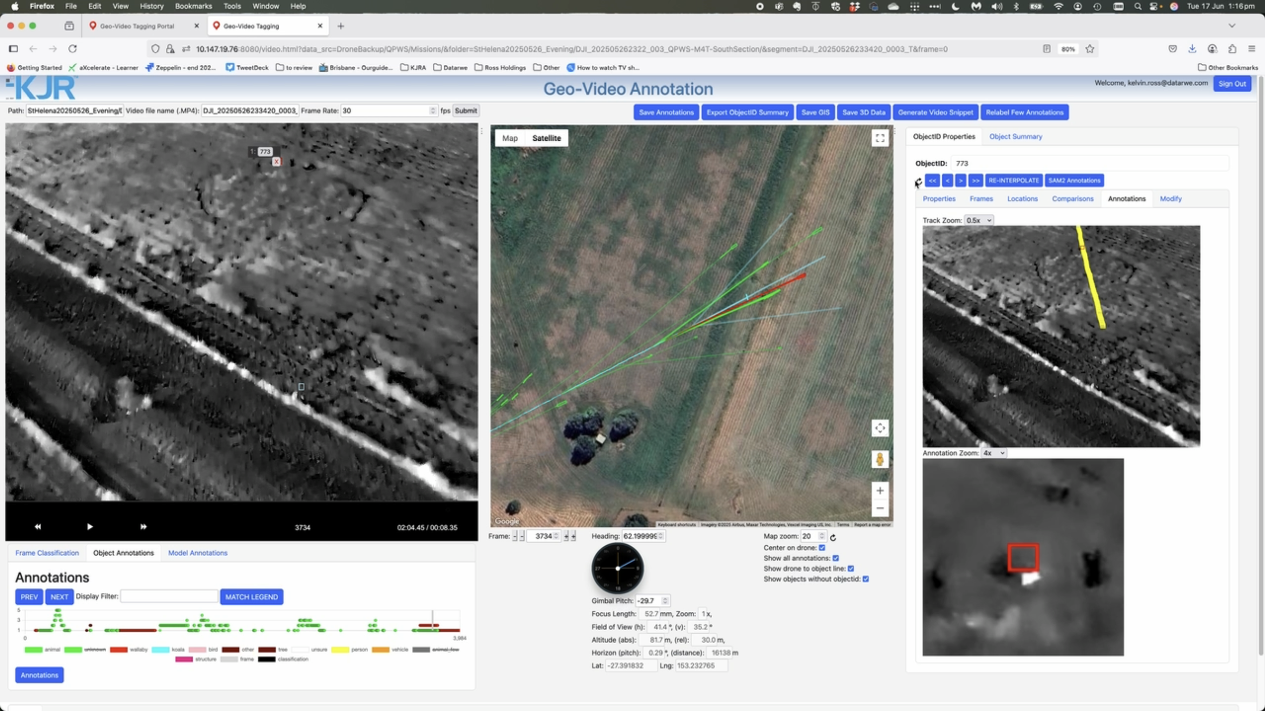
Dashboards, maps, evidence review, alerts and human-in-the-loop workflows that put the information into operational use.
SEE. UNDERSTAND. ACT.
From the field to the decision.
A remote system is only useful when the full chain works. We design around that operational chain rather than around an individual piece of technology.
-
01 · Deploy
Put sensing and compute where the mission requires it — fixed, mobile, autonomous or crewed.
-
02 · Connect
Move data using the right mix of satellite, cellular, local networking and cloud services.
-
03 · Understand
Use AI, analytics and human review to identify what matters and retain the evidence.
-
04 · Act
Surface the result through dashboards, maps, alerts, reports and integrations.
PROVEN IN THE FIELD
Engineering depth behind the system.
KushAI combines hands-on experience building and QA-ing computer vision and drone workflows with decades of broader machine-learning, software and safety-critical systems experience.
That matters when the job is not just to make a model work, but to make the complete system reliable enough for people to use operationally.
-
5+ years building & QA-ing CV / drone workflows
Real-world imagery, detection, tracking, geospatial processing and operational validation.
-
XX+ surveys through AI / GVA workflows
A direct measure of operational use rather than a model-development vanity metric.
REPLACE WITH VERIFIED SURVEY COUNT
-
YY+ hours of imagery or video analysed
Use this only if we can calculate the figure consistently across projects and data types.
REPLACE WITH VERIFIED PROCESSING FIGURE
-
~30 years combined engineering experience
Across machine learning, software engineering, QA and safety-critical systems.
SYSTEMS INTEGRATION IN PRACTICE
More than a drone. More than a model.
Remote operations depend on the complete system: power, communications, autonomous platforms, sensors, compute, software, AI and the people operating it.
KushAI brings those pieces together into deployable systems and can extend an established environment where you already have part of the stack.
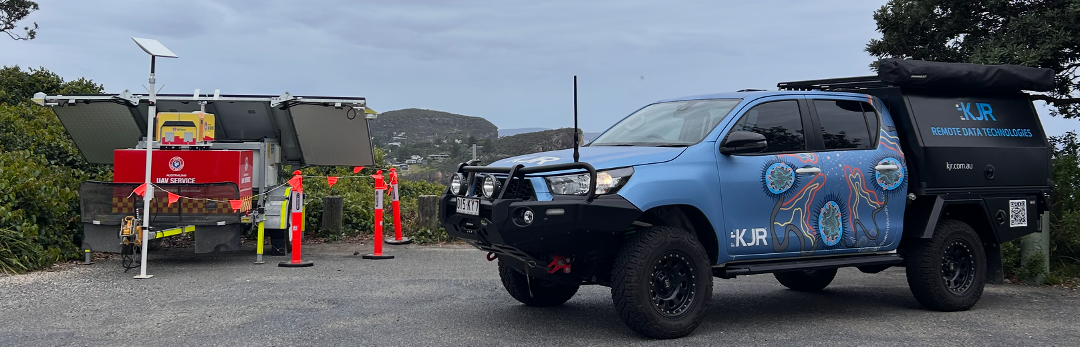
Mobile & off-grid — Platforms designed for remote and changing operating locations.
Remote operations — Connectivity and software designed around the way the mission is actually run.
AI-enabled — Computer vision where it reduces workload, improves awareness or creates new capability.
Human-controlled — Interfaces and evidence designed so operators stay in control of consequential decisions.
OPERATIONAL APPLICATIONS
Applied where remote visibility matters.
We focus on environments where collecting the data is hard, connectivity matters, and the information needs to reach an operator in a useful form.
-
Coastal & Public Safety
Remote drone operations, situational awareness, AI-assisted detection and evidence workflows.
-
Environment & Biosecurity
Remote surveys, computer vision, human review, mapped observations and repeatable reporting.
-
Infrastructure & Remote Sites
Persistent sensing, remote inspection, geospatial context and operational data access.
SOFTWARE & AI ENGAGEMENTS
Already have the hardware?
You do not need to buy a trailer or a drone to work with us. We also build and integrate the software, AI and data layers that sit on top of existing field systems.
That can mean a computer vision model, a geospatial workflow, a dashboard, an evidence-review interface, or integration between systems you already use.
DJI ENTERPRISE
Enterprise platforms, integrated into the wider system.
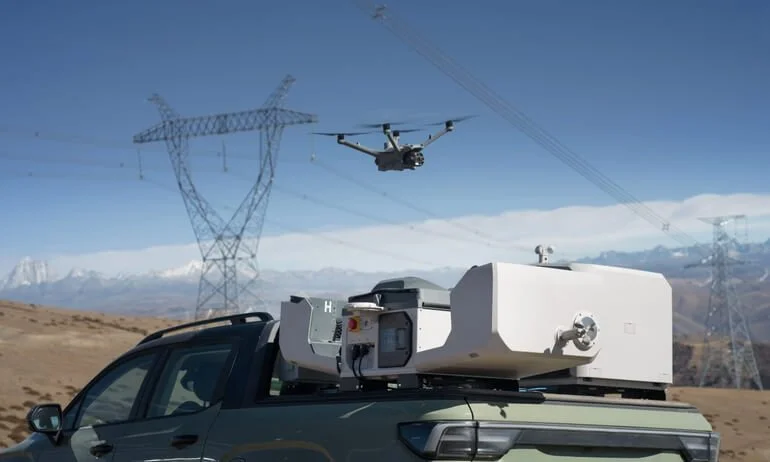
As an accredited DJI Enterprise Dealer, KushAI can supply, configure and support DJI platforms — and integrate them with the power, connectivity, data and software required to make them useful in the field.
START WITH THE OPERATIONAL NEED
What needs to happen remotely — and what does your team need to know?
Tell us about the operating environment, the data you need, the decisions people need to make and the systems already in place. We can help define the smallest useful system or integration to start with.