Real Impact in the Field
Learn how Kushai’s drone and AI solutions deliver real-world impact across environments, communities, and critical industries
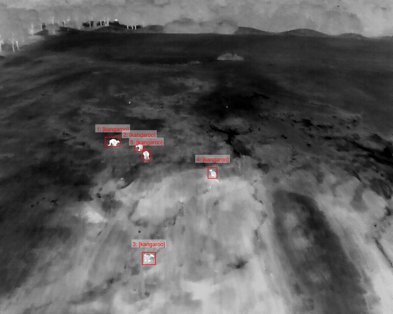
Feral AI
AI-powered drone monitoring for pigs, rabbits, kangaroos, and invasive species across rugged terrain.
Outcome: Faster surveys, reduced labour, data-backed wildlife management.
Background
Feral-AI is an innovative program from Kushai using drones and artificial intelligence to monitor and manage invasive species and environmental threats across Australia’s landscapes. By combining autonomous drone systems with edge-based AI models, the technology can detect, classify, and track feral animals such as pigs, rabbits, and wallabies, as well as assess impacts on native wildlife and ecosystems.
Projects include aerial surveys in rugged terrain, supporting Indigenous ranger groups with cultural site protection, and biosecurity monitoring to reduce agricultural damage. Feral-AI reduces the need for manual fieldwork, delivers faster and more accurate insights, and strengthens ecological management and biodiversity conservation..
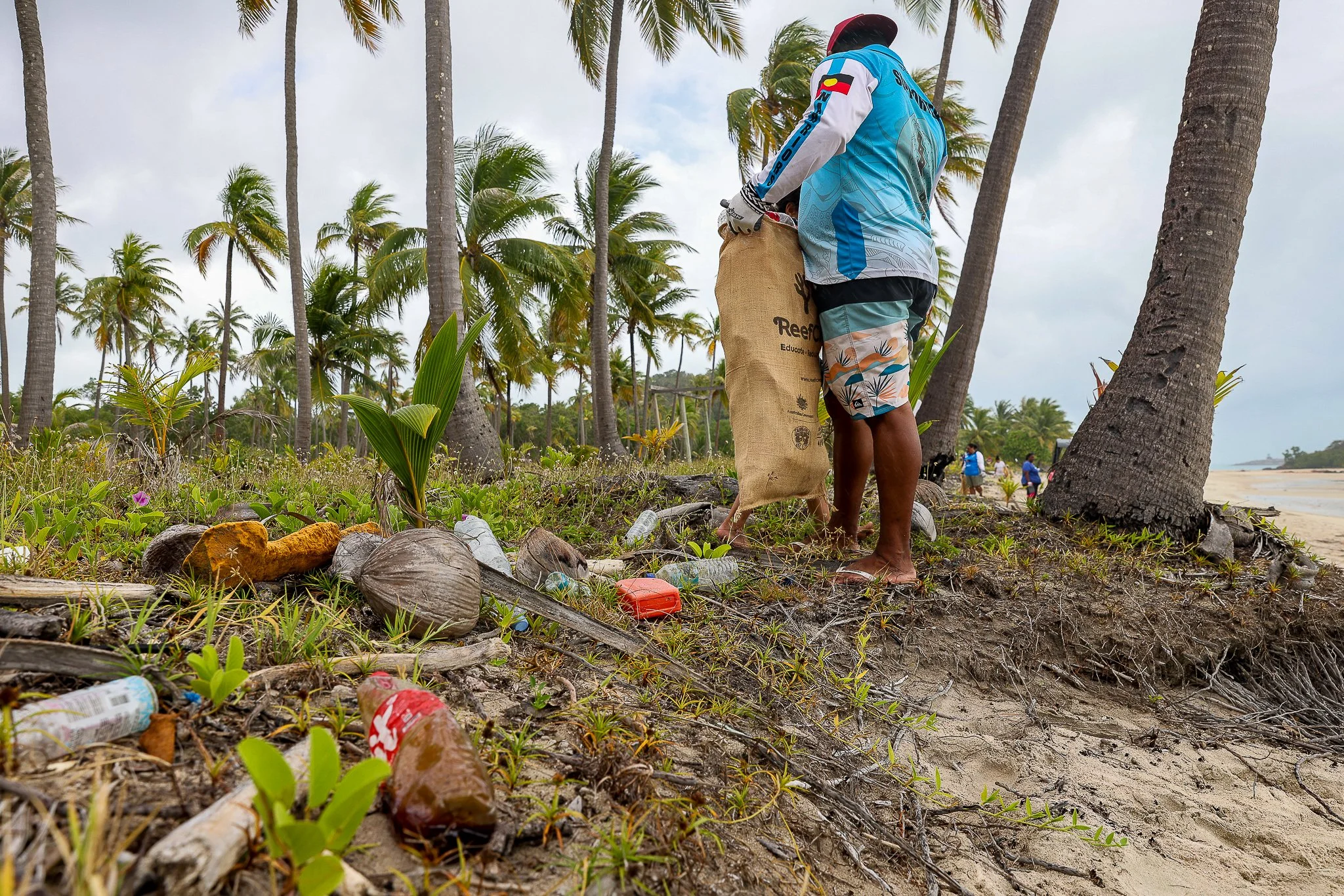
Marine Debris Task Force
Drone and AI systems detecting ghost nets and marine debris along remote coasts.
Outcome: Targeted clean-up, improved reporting, empowered local ranger groups.
Background
The Marine Debris Taskforce is a collaborative initiative tackling pollution along Australia’s coastlines and islands. Kushai contributes by delivering AI-driven drone and remote data solutions to detect, classify, and map marine debris in hard-to-reach regions.
Using solar-powered, trailer-mounted drone systems with Starlink connectivity, Kushai enables real-time, off-grid monitoring. Edge-based AI models rapidly identify debris types and pollution sources, supporting targeted clean-up strategies and long-term ecological management.
By partnering with Indigenous ranger groups and environmental agencies, Kushai ensures culturally aligned deployment, training, and community ownership. This project demonstrates how trusted AI and remote data platforms strengthen environmental stewardship and coastal resilience.
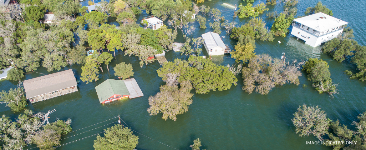
Flood Response
Solar-powered drone dock deployed during floods with continuous aerial assessment.
Outcome: Real-time situational awareness for emergency teams.
Background
Kushai provides advanced, off-grid drone technology solutions to support disaster response and emergency management. In collaboration with Indigenous ranger groups, Kushai has deployed autonomous drone docks mounted on solar-powered, trailer-based platforms with Starlink satellite connectivity, ensuring continuous operation in extreme conditions. These systems capture real-time aerial imagery, track rising water levels, inspect infrastructure damage, and detect hazards such as debris in waterways.
By delivering immediate situational awareness to on-site teams and remote stakeholders, Kushai enables faster, safer decision-making. With expertise in autonomous systems, AI-enhanced analysis, and resilient design, Kushai’s solutions are a powerful tool for disaster preparedness and response.

Public Safety
Drone and AI tech providing real-time monitoring, enhancing safety, monitoring, and response
Outcome: Improved safety, faster decisions, enhanced emergency response.
Background
Canberra’s Skyfire event in 2025 saw Kushai supporting emergency services by deploying advanced drone and AI-enabled data technologies to enhance public safety and situational awareness.
Using multiple drone systems with live-streaming capabilities, Kushai enabled real-time aerial monitoring of crowd movements, traffic flows, and potential hazards. This provided event organisers and first responders with accurate, up-to-the-minute intelligence to support rapid decision-making and emergency response coordination.
Kushai’s expertise in autonomous systems, real-time data integration, and AI-powered analysis ensured the technology delivered safe reliable insights in a complex, high-density environment, demonstrating its value for large-scale public events and urban safety management.
We fuse data from autonomous platforms to deliver actionable insight — anywhere, anytime.